山东地情档案 AI 原始文本
文章:第四章 北金堤滞洪区
资料库:聊城地区黄河志
章节:第二篇 防洪工程
导航链接:
首页:https://shandong-chorography.org/
根目录:https://shandong-chorography.org/toc.md
资料库:https://shandong-chorography.org/database/liaocheng-yellow-river/
资料库目录:https://shandong-chorography.org/database/liaocheng-yellow-river/toc.md
章节:https://shandong-chorography.org/database/liaocheng-yellow-river/section/4/
章节目录:https://shandong-chorography.org/database/liaocheng-yellow-river/section/4/toc.md
网页版本:https://shandong-chorography.org/database/liaocheng-yellow-river/section/4/article/62/
本 TXT:https://shandong-chorography.org/database/liaocheng-yellow-river/section/4/article/62/index.txt
===== 原始正文(以下内容未经加工) =====
万人的安置工作。为保证滞洪区群众及时撤离和防汛抢险的需要,规划拟修建的防汛晴雨公路仅完成一条,尚有6条共61公里尚未修做。由于分洪预见期短、交通拥挤、桥梁稀少,群众撤离迁安问题很多。
北金堤防汛抢险料物、备防石料短缺,照明及运输设备严重不足;通讯设备问题很多,无线通讯网尚不健全,很不适应防洪要求。
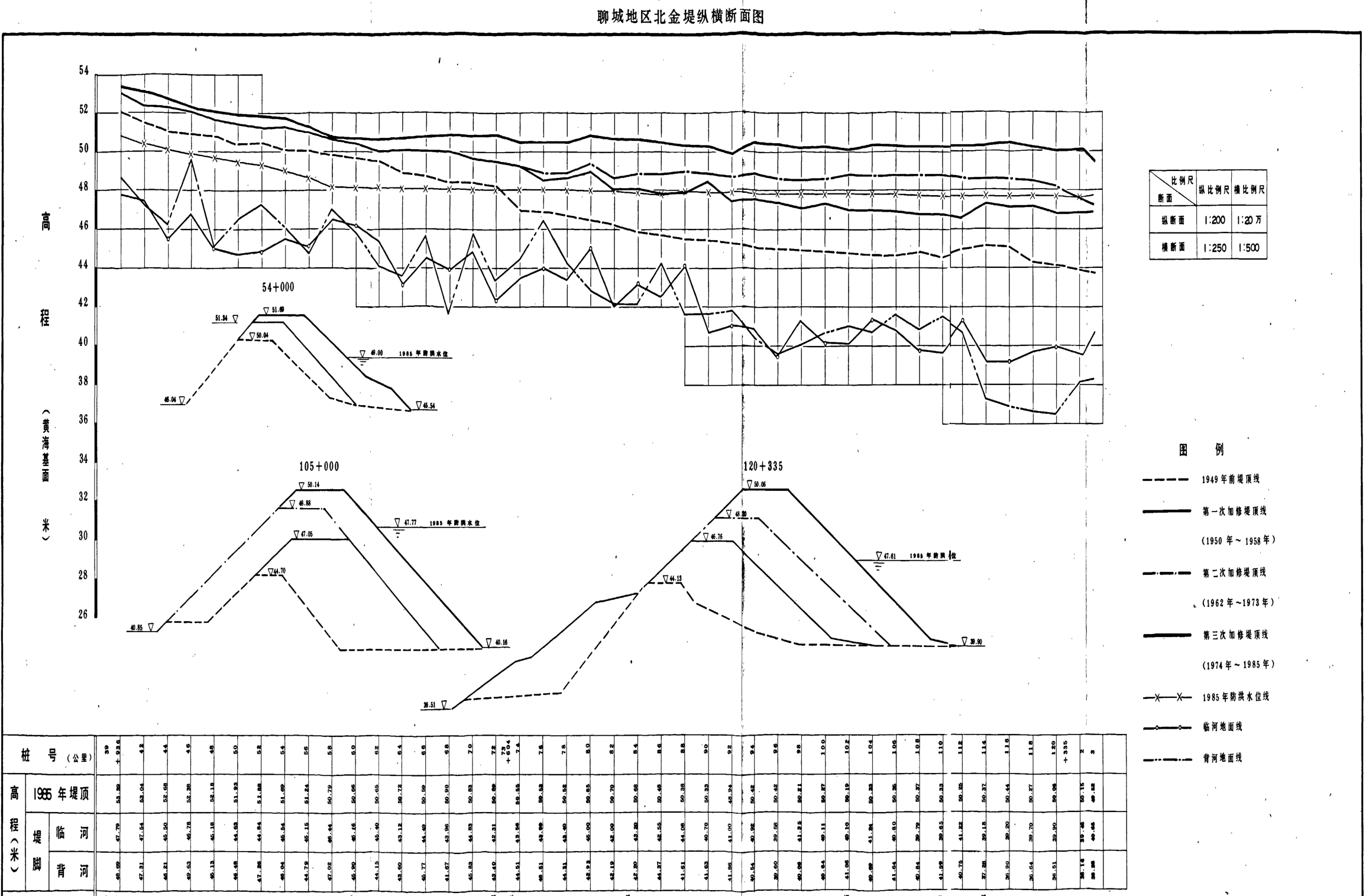 聊城地区北金堤纵横断面图
比例尺表:
| 断面 | 纵比例尺 | 横比例尺 |
|---|
| 纵断面 | 1:200 | 1:20万 |
| 横断面 | 1:250 | 1:500 |
图例:
- - - - 1949年前堤顶线
- 第一次加修堤顶线(1950年~1958年)
- · - · 第二次加修堤顶线(1962年~1973年)
—— 第三次加修堤顶线(1974年~1985年) -×-×- 1985年防洪水位线 -◎-◎- 临河地面线 -—— 背河地面线
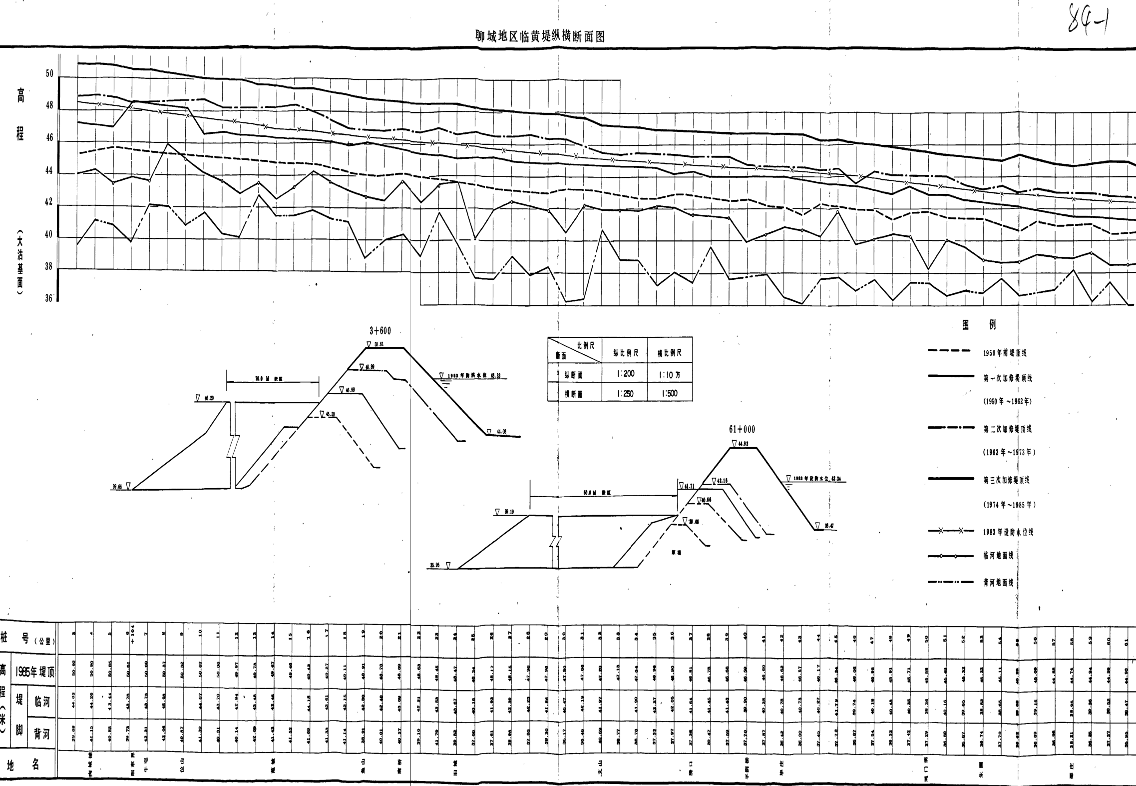 聊城地区临黄堤纵横断面图
===== 原始正文结束 =====
聊城地区临黄堤纵横断面图
===== 原始正文结束 =====